


Joining the Open Data rebels as a newcomer: FOSS4G behind the scenes


This was my first time at FOSS4G, so I will admit something straight away. I am not a technical person. I work with stories, people and messages more than code, servers or anything with “stack” in its name. So when I opened the FOSS4G Auckland 2025 in Aotearoa New Zealand schedule and saw pages of workshops, keynotes and lightning talks, it felt a bit like looking at a wall of acronyms. But it also felt exciting, like walking into a giant talanoa under one roof where everyone cares deeply about maps, places and people, just in a different language from mine.

FOSS4G, short for Free and Open Source Software for Geospatial, is basically the global gathering for people who work with maps and location data using free tools. “Geospatial” sounds complicated, but it just means information (like satellite maps and space) that is tied to a place, for example, a coastline, a village, a river or a road. The conference brings together developers, scientists, students, governments, humanitarian organisations and anyone who believes these tools should be open and available to all. For me, it felt like a mix of training, talanoa and a celebration of what open collaboration can mean for regions like ours in the Pacific, where distance is measured in ocean, not kilometres, and where decisions land in real communities fast.
In 2025, the Pacific Community (SPC) was a gold sponsor, which meant the Pacific was not just in the audience; we were on the programme and on the stage. I was there with SPC's Earth and Ocean Observation team, listening and watching as they explained their work to rooms full of highly technical people. One of our programmes, Digital Earth Pacific (DE Pacific), is a regional satellite data system that helps Pacific countries and territories track changes on land and at sea over time across our Blue Pacific continent. In simple terms, it turns satellite imagery into information that leaders can use to plan for issues such as coastal erosion, floods, and land use, the everyday realities behind the headlines, from king tides to cyclone recovery.
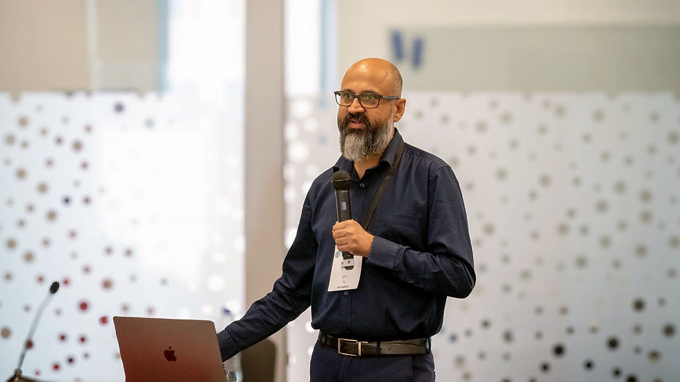
As SPC’s Team Leader for Earth and Ocean Observation, Sachindra Sing puts it: “Digital Earth Pacific was designed with our member countries and territories, not in isolation from them, so being at FOSS4G 2025 was a chance to bring those Pacific voices into a global open source space. We talked about land, coasts and communities that are on the frontlines of climate change, and we found developers and partners who genuinely want to build with us, not just for us.”

One of the key moments for me was SPC’s workshop on participatory mapping and something called machine learning, which is basically teaching a computer by showing it lots of examples, so it can learn to spot things on its own, like recognising structures, floods and many other examples, in pictures. As a non-technical person, I expected to be lost. Instead, what I saw was very human. The team showed how tools like QField, a mobile app that lets people collect information in the field with a phone or tablet, can be used by communities to map their own coastlines, farms, and forests, and then connect that local knowledge to the bigger Digital Earth Pacific system. It felt less like a fancy technology demo and more like giving people in villages and settlements a stronger voice in decisions, the kind of practical power that matters when you live close to the shoreline, or far from the main island office.

Nicholas Merthell, SPC's Earth Observation Officer - Data Analysis and Technical Support, explained that the work behind Digital Earth Pacific is not just about clever code, it’s about co-creating tools with countries, in ways that actually stick. He pointed to the Land Cover Assessment Skills Transfer (LCAST) workshop in Tonga in July 2023, where staff from seven Tongan ministries spent a week collecting field data with simple open tools, then bringing it into the lab to build and check national land-cover models together. Since then, the same participatory, open-source approach has been used in similar country-led workshops with more than 240 participants across 10 Pacific Island countries and territories, helping local teams map land use and land cover, test accuracy, and grow long-term capacity in Earth observation without relying on expensive, closed systems.

Another SPC session that helped me see what all this technology looks like in real life was presented by Elenoa Likutotoka Biukoto, SPC's Earth Observation – Technical Officer, on “Identifying Forest Invasive Species in Fiji and Tonga Using Machine Learning”. She explained that deforestation and forest degradation in our region are opening the door to invasive plants that damage biodiversity, disrupt ecological connections, and threaten people’s livelihoods. Using Digital Earth Pacific, her team combined field-collected GPS points with satellite images over time, then used machine learning to track how quickly these invasive trees spread across damaged landscapes. For someone like me, who does not work with code, it was a powerful example of how Earth observation and smart models can help Pacific countries actually see what is happening in their forests and act before the problem becomes too big to manage.
"Create more awareness on the impacts that Invasive species have on our land and native forests, not just for Fiji and Tonga, but potentially other islands with large forest areas."

Hearing that in a room where many people could probably write code in their sleep made a big impression on me. It reminded me that the real point of all these tools is not the software. It is the people and the places they are trying to protect, our vanua, our moana, and the everyday decisions tied to them. The Pacific Data Hub (PDH) session is built on that same idea. PDH is our regional gateway for Pacific data. The technical description is that it is a federated platform, but in normal language, it is more like a front door that helps you find data that still lives in many different homes and ministries. Countries, agencies, and partners retain control over their own information, but PDH makes it easier to discover, access, and use it. For a region like ours, spread out across a vast ocean with many small administrations, that approach feels very Pacific. It respects sovereignty and local control, while still helping us connect the dots across the region.
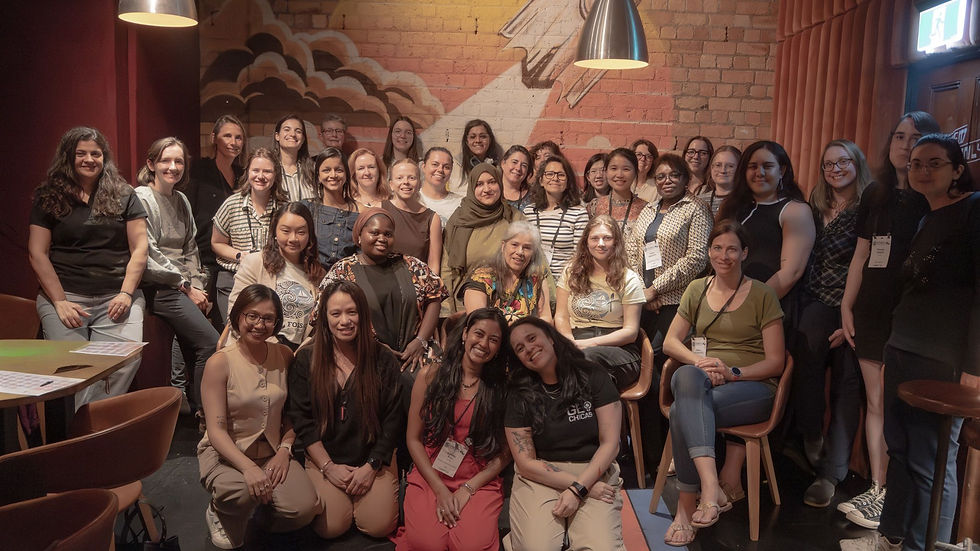
One of the most unexpected highlights for me came from outside the Pacific. Geochicas, a volunteer-led community working to increase women's participation in mapping and open-source spaces, shared their story. Co-founder Selene Yand Rappaccioli explained that they focus on women’s roles in decision-making spaces and on ensuring women’s realities are reflected in the maps, software, and communities they build. Their work started in Latin America but now reaches women in many parts of the world, proof that the “map” is never neutral, and who holds the pen matters.

Listening to Selene speak about gender bias in mapping and technology, and about building safe spaces for women to learn and lead, felt very familiar. The examples were from Latin America, but the themes could easily have come from Suva, Apia or Honiara, even from outer islands where opportunity can feel one flight away. As she said, GeoChicas is just one example of how people need to come together to face these challenges. For me, their session created an unexpected bridge between their region and ours, and connected strongly with the work Pacific women in GIS and geospatial networks are already doing.
That link became even clearer during the session on the Pacific Geospatial Women Network (PGWN), presented by Jacqueline Singh, Technical Assistant. She shared how the network was established, its objectives, and the various activities and engagements already underway across the region. PGWN is about building a community for Pacific women in geospatial, creating spaces to learn, connect, and lead, and opening doors to future funding and collaboration with similar projects around the world. As Jacqueline put it:

“What’s so empowering and amazing about the collaboration with local women? These are women who have never heard of GIS or all the fancy technologies we now have now. GIS doesn’t require someone to have prior experience in technology; it is about how well you know your surroundings.”
She also reminded us of the heart of the network’s work: “PGWN focuses on empowering Pacific women by promoting geospatial science education and career opportunities, fostering an inclusive community where women can learn, innovate and lead in the geospatial field.”
Sitting there as a Pacific attendee, it felt it was less like a side project and more like a movement quietly reshaping who gets to hold the map.
Another thing that stood out to me as a first-time attendee was how many Pacific faces I saw in the crowd and on stage. There were young practitioners asking sharp questions, experimenting with tools they had only read about, and openly discussing practical problems like low internet speeds, small teams, and the reality of working across many islands. Our realities are very different from those of large, well-resourced agencies, and it was encouraging to see those realities taken seriously.
During a conversation with Vanshika Nandini, a Geospatial Technical Officer Geospatial at the Mineral Resources Department in Fiji, she described it in a way that made sense even for someone like me.
“FOSS4G is a good learning opportunity. You get to learn how to use your GIS workflows, you get to learn about different open source software like QGIS, and you learn to create different types of maps by using tools. It is a very good learning and networking opportunity.” Hearing that from another Pacific participant helped me realise I was not the only one learning to translate the tech talk into something that fits our day-to-day work.
What I appreciated most was the attitude of many international participants when we spoke about island contexts. Instead of saying “here is the solution, just copy it”, they asked what works with low bandwidth, how to keep systems simple for small teams, and how to respect local knowledge and data ownership. That listening turns a global conference into something that feels closer to Pacific values of partnership and respect.
By the time I stepped out to the Auckland waterfront at the end of the week, my brain was tired, but my heart felt full. The harbour wind, the small groups still deep in conversation, the quiet sense that people were going home with new ideas and possible collaborations. If you swapped the jackets for bula shirts and puletasi, it really could have been a Pacific meeting.

FOSS4G 2025 featured many complex diagrams and technical sessions, and I did not understand every line of code or acronym. But even as a non-technical person, what stayed with me was the feeling that the Pacific is not a footnote in this story. We are active contributors, innovators, and collaborators. We bring our ocean, our cultures and our resilience into conversations about data and technology that often forget small islands.
For me, the real work starts now that we are back home. The challenge is to turn that conference energy into simple, practical tools and strong partnerships that make a difference for Pacific people. That might look like a community using a tablet to map its coastal erosion, a ministry using satellite data to prepare for cyclone season, or a group of young women finding their voice in the geospatial space.


Comments